Fitting my farm into bureaucratic boxes
Farming, conservation, money and maps. Why nothing seems to fit comfortably on my land at the moment.

I opened the email with a sense of dull déjà vu. I’ve been here before, many times.
A countryside stewardship claim revenue review email, saying my claimed land does not quite match what they ‘know’ about my land, so they will just be lopping off a touch of the claim money here and there to make it all fit nicely.
Déjà vu indeed.
It used to be a yearly BPS claim review, saying the same. Here be woods, not grazing land, therefore we cannot pay you. A yearly back and forth with photos of cows grazing happily under trees and field numbers with four-letter codes beside them. WO12, PG01 … scrub (WO25) and rocks (NF01) were sometimes added to jazz things up a bit, but mostly it was ‘satellite says trees’ and into battle I stepped full of righteous ‘I farm it therefore it’s agricultural, therefore it’s worthy of its payment’ anger. Some years I’d admit mistakes had been made. Scrub can really be ungrazable, calling that huge fallen oak agricultural land as it became a wild bird haven might have been pushing it, rocks are not soil (cough, peat map, cough) but mostly the claim was paid in the end and the emails filed for another day. BPS had a nasty tidy mind, straighten up, tidy up or else. It’s one of the reasons farmers are now accused so often of destroying nature, we were literally paid to clear that scrub, and if we didn’t we heard about it fast enough.

I was not expecting a double check about my mid-tier countryside stewardship claim though. It’s been running along fine for a few years now and other than a bit of hedge discussion with an interesting and knowledgeable inspector, it’s been easy enough. Still, I don’t actually mind having to don my armour and roll into bureaucratic battle over such things. People in farming and land management lie, cheat and make mistakes as often as anyone else, and I can see why someone used to big flat tidy fields may eye up a woodland edge claimed as pasture with suspicion. According to the boxes my woods are woods, and pasture is not woods. Fair enough, I have my evidence to back up my claim, and it’s just some emailing after all. Out come the latest pictures of cows grazing under trees and with a swift prayer to the patron saint of emails (I think it’s probably Catherine of Alexandria as she saint in charge of scribes, but I suppose it may be Matthew, he of the tax office…) I’m done.
Land that doesn’t quite fit
The problem is, you see, my land that is not typical, it fits uncomfortably into the boxes, edges stick out, scrub gets away, trees stretch out into places they really should not be, and I don’t farm in a typical way. We graze the woods, we let the cows push through the scrub, the bracken ebbs and flows across the land depending on the weather, the season and our fortitude. I’ve even blocked land drains then grazed the new bogs. The messy edges are farmed as hard as the flat green bits. It’s all used, all farmed, there is no divide. And that makes it awkward. How can you easily quantify (and put a value on) something as fluid as nature-focused farming?
And I am not the only one with awkward land. I doubt anyone has a a whole farm that fits nicely into the spreadsheets, jigsaws into the maps with no lost pieces. Not unless it’s been scraped clean and squared off very efficiently indeed. The field edges, the weird hollows, that bit of grazing you always get in the woods. The hard standing that was a yard years back and is now botanically interesting lichen and moss.
We have a payment and regulatory system for land use built from behind a desk, a system that is supposed to support farming and nature, but we have built it in black and white, all straight lines and right angles, binaries where multitudes should be. What it needs is to be like water, and flow.
The landscape recovery… a new dawn
I have one more year of my mid-tier countryside stewardship agreement, an extra year I am truly thankful for, and then it looks like we will be stepping boldly into the new world of landscape recovery. Bigger, bolder, joined-up thinking. Habitats that roll from farm to farm and across our hills with abandon. Rivers ribboning out of their channels, woods expanding, land becoming a messy mix of uses and life. It is exciting and we have been working towards it for years now, getting a whole community of very different people interested, involved, agreeing to change decades of work so a beetle, bat or bird may have a better chance at survival.
The problem is the boxes, codes, and maps have followed us here, pushed into our brave and bright corner. Dull black and white spreadsheets. Maps that have no shades of grey. Four-letter codes with rules attached.
A mature wood pasture, (or wood with pasture, or pasture edged with wood), is mapped from on high as some wood and some pasture. Two separate land uses. Not a field of pure magic, but two distinct payment types (one less than the other) with two distinct management options. Once more, having unruly land may cost me.
I understand that there must be rules. Checks made and forms filled. If you want paying, especially by the taxpayer, especially nowadays, you had better be producing the goods. But it’s really not easy when the goods you are to produce are self-willed and wild. 20% tree cover or 10% standing deadwood sounds great, but one good storm could untick that box for you easily. And what if the plants don’t respond to climate change well and we all end up with just the one tough old resilient plant instead of a multitude of delicate wonders? What if the four-letter codes are found to have unworkable rules in the real world?
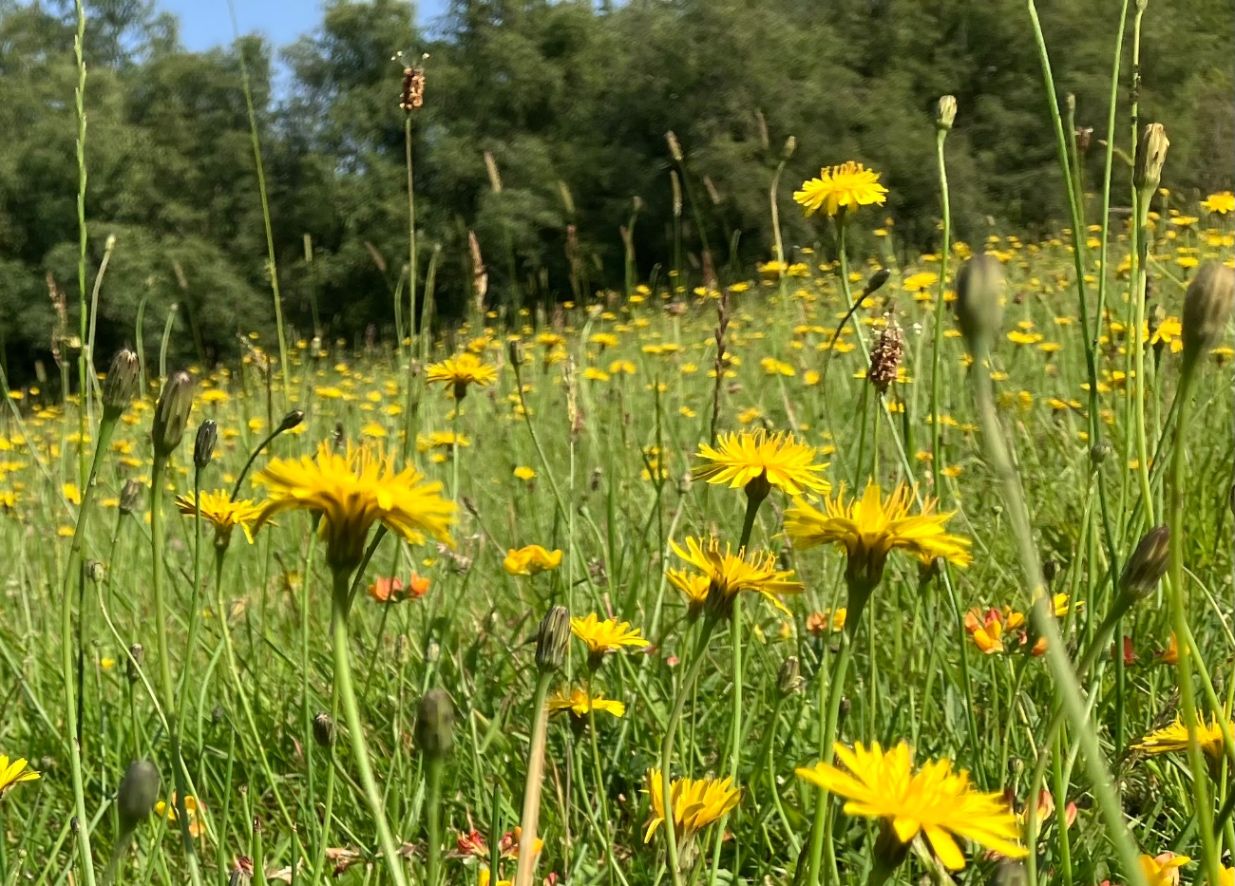
I have a patch of pasture, unimproved. It may have had some muck and lime a hundred years ago, but nothing since. It’s ridiculous to think of farming it in today’s machinery world. Impossible access, very thin soil, and on paper, not species rich enough to tick the boxes. (15 species in a square metre of different plants, not including the boring ones). It was, when I went to count the species, pretty much a monoculture of hawkbit. A glorious carpet of colour and bees. Not the best grazing for fast efficient growth that’s for sure but bloody hell it was beautiful. Self-willed, wild, with light pulses of grazing throughout the year, quietly doing its thing, adding flavour to the meat and space for the wild. It is heaven.
Early in the year it was a carpet of Celandines, and in May Pignut joined in while the hawthorns hummed with bees, in January it will be mostly moss. It probably will meet the 15 species rule if I go and count every month, but if I was inspected, on a random day, it may well fall short. So ticking a species rich box to get a payment is a risk. Am I setting myself up to fail? Does the moss count against me? Or do the waxcaps add points? Who makes up the scoring system? It’s an overthinker’s nightmare, but to make it pay its way I have to fit this land into the boxes, agree to manage it according to the rules attached to the code or, heaven forbid, widen the gateway and get in there with some agricultural ‘improvements’. It’s a hard choice, and if I fail to meet the scheme’s aims by choosing the wrong box I face paying back years of money or damaging a special ecosystem.
Maps and mismapping
Along with the boxes, spreadsheets and codes are maps. They sit side by side on open laptop tabs and inform decision making.
Now I do rather love a good map. Old ones of places I know, or brand new LiDAR, really detailed Ordnance Surveys or barely legible second hand finds, they are a delight. But maps, like history, are made by those in charge and sometimes those people in charge map things out in ways that baffle me (cough, peat map, cough). Maps that are made from real life observations are brilliant, but ones based in modelling and desk-based surveys? Well they don’t quite fit the land in the same way as an Edwardian Ordnance Survey does.
My land is mapped at the moment on various systems, some within the government, some private sector, eNGOs and activists love making them to illustrate their goals, and those maps all seem to take liberties.
On the government maps I’ve got:
A 1 in 3 gradient field mapped as fen, swamp or marsh. It’s mapped as high potential for wet woodland creation, and also mapped as actual woodland on a different maps. In reality it is a very steep, very dry pasture with some scrub on the steepest bits.
I’ve peat mapped where rocks are. (And late afternoon shadows are mapped as bare peat).
I’ve a small conifer plantation mapped that doesn’t exist and never has.
Hedges mapped as walls and walls mapped as hedges
I’ve a public road crossing my land mapped as a peat cut
I’ve a dry stony wood mapped as molinia dominated bog, or dry scrub, or heather
I’ve rocks mapped as trees
A long destroyed medieval wood bank mapped as a field boundary
A very strange bit of stream that ends suddenly and then starts again for no reason
And
I have had a large (well mapped scheduled ancient monument) ruined medieval village, mapped as many tiny fields (each with an individual field parcel identification number) (and each too small to claim BPS on).
And it’s not just me, everyone in the world of land management and farming has issues with the maps, from odd land uses to non-existent walls, it’s just part and parcel of having land. I even know of someone who had his stacked wrapped bales flagged up as a new barn.
And these new, computer modelled, maps have a central place in the world of landscape change, ecology and farming. If the map or satellite image says woods, then it’s up to me to say ‘yeah but no’ to the civil servants, rather than them sending someone out to check first. I get it, it would cost the earth to check all the corners, and why bother? But I fear there is a sneaking belief that if it’s mapped and looks official it must be right. ‘Computer says no’ is a little too close for comfort, after all a map can only tell a two-dimensional story and the tools used are akin to trying to paint a miniature with decorators rollers. These maps can never be more than a rough idea.
The future… unmapped and set free from the boxes?
I am tired. Tired of trying to shove unruly land into tidy boxes. Tired of having to second guess nature so I don’t sign up to the wrong option. Tired of finding mistakes in maps that I need to fix before I can do anything. I just want it to be easy and it’s not.
My wish for an easy option is not just based on laziness, it’s practical too. If we could have a ‘lazy mosaic’ land management option, one that paid us enough money to take our foot off the ‘go faster, grow more’ pedal for a bit, and let the land sort itself out, imagine how many would choose it? How huge the impact would be? Imagine how a simplified scheme could work... Thrown over land like a comfortable blanket, ‘here be a sleeping giant, ready to spring to life’. Imagine if we felt ok about just trying something, or stopping something? Imagine space to make mistakes. Imagine if all we needed to do to get ecological advice was pick up the phone and book a session with an expert. Imagine if that expert had the right information on their system and believed us when we said we had snipe there, or a rare plant, or fungi. (A healthy bit of scepticism would be needed mind you; charlatans and fools do roam even these lands!) Imagine if we had comfortable boxes to tick…
But until that day, I shall just keep on choosing uncomfortable options, sending emails, and grumbling on about maps. (Cough, Natural England’s New Peat map…. Cough)